When it comes to bike touring navigation, a mix of route planning methods are probably best. Find the perfect balance between real maps, smartphones, and local advice to plan the ultimate bike touring trip!
Bike Touring Route Planning
If only bicycle touring were as simple as just riding a bike, how easy it would all be!
There's more to it than that though, and bicycle touring navigation is one of those things you will need to consider sooner or later.
Sure, you have your bike and gear sorted out, but how exactly are you going to find your way around?
Getting from A to B is only possible if you know where A and B are in the first place, after all!
Well, there are three basic methods to bicycle touring navigation, and these are to use maps, a GPS, and seek local knowledge.
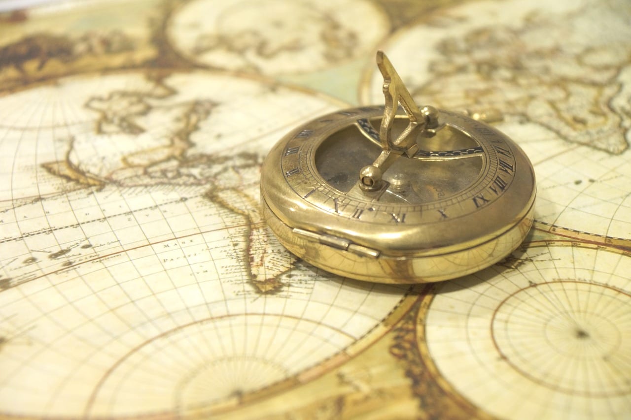
Bicycle Touring Navigation – Maps
Is it only me, or do other people find something very special about spreading a map out, and spending hours looking and planning from it? It's quite easy to become absorbed in one, tracing a road or trail with a finger whilst visualising how the countryside around it might look.
The ‘Google' generation, used to Google Earth and Maps, may never come to realise this same feeling. Such a shame.
Lets not get all nostalgic though. Just because looking at maps feels great, does not mean that they are the best thing to use for bike navigation.
Are paper maps practical for bike touring?
The problem with using maps for bicycle touring navigation is in the detail. By definition, the more detail a map provides, the smaller the area it covers. When bicycle touring, this proves to be a bit of an issue.
Any map with a decent enough scale will only last a weeks worth of cycling, if that. Then, you would have to buy another one, and then another one as you cycled through new terrain.
For cyclists on extended journeys this soon proves to be impractical due to the weight of carrying the maps, their availability, or just the cost of them.
Don't panic
It's not all doom and gloom though. For many countries, there might only be a choice of one or two roads to take. In this instance, it doesn't really matter what scale the map is. In fact, sometimes, you don't need one at all.
I remember in Sudan that there was really only one road to take towards Khartoum, and I had no map to follow whatsoever. Once I was on the road, things were pretty simple.
(OK, first I had to cycle through some desert regions, but that's a different story!). In many other countries that I have cycled through, the same could also be said.
Final thoughts on paper maps for bike touring
Using maps for bicycle touring navigation has its pros and cons. Good quality detailed maps are often expensive and hard to find, and regional or country maps offer no more detail than that found in a Lonely Planet guidebook.
Maps can be a bit of a comfort tool though, and its also a great way to communicate with people from other countries. Even if language is a barrier, bringing out a map provides something in common with the other person.
Sometimes, on those special occasions, it may even be the first time someone has seen a map of their country or even of the world. Those are the times when memories are made.
Smartphone Maps
This is increasingly becoming bike touring navigation tool of choice. Smartphones still suffer from the battery problems of GPS units, probably more so in fact, but it does mean one gadget less. Take along a powerbank, and you can keep topped up for several days at a time.
I solely use smartphone apps for bikepacking navigation now. For a recent bike tour around Iceland, I used Komoot and it worked very well. Try it out and see what you think!
You might also want to read:
- Electronic Gear To Take On A Bicycle Tour: Cameras, GPS, and Gadgets
- How to charge your phone when camping
Bicycle Touring Navigation – GPS
Way back when, (not quite the stone ages), when I started bicycle touring, GPS devices for cycling were non existent. The first ones to eventually come on to the market were big. clumsy things with terrible battery life. For this reason, I gave them a wide berth.
Fast forward a decade or so, and there are now dozens of different GPS devices all suitable for cycling with.
I finally succumbed to buying one, and have spent a little while testing this gps for bike touring. I have to say, that I was for the most part pleasantly surprised.
Garmin Edge Touring Plus

The positive and negative aspects of cycling GPS devices for bicycle touring navigation both come from basically two things.
One, is the quality of the maps they are using, and the other, is in the units battery life. Lets start with the quality of maps first of all.
My Garmin Edge Touring Plus uses maps from OpenStreetMaps. On some wonderful occasions, it directed me through cities I had never been to before, all along quiet cycle routes away from busy main roads.
On other not so wonderful occasions, it took me along what it described as cycle paths, only for me to find a style entering a farmers field and an overgrown byway. Which would have been perfect if I was hiking but not cycling!
So, the lesson learned here, is that GPS devices, like any electronic device, are only as clever as the information input into them.
Battery life on cycling GPS
Battery life is the other issue. Most bike touring GPS devices now good enough to provide one, if not two days power. Which is fine if you can keep it charged on a regular basis.
If you are cycling through the back of beyond and wild camping along the way, then power might be a bit of an issue. Sure, you can get a solar setup to keep it charged, but then we are back to adding more weight to your load.
At the point you are carrying a kilogram of tech gear just to keep your GPS charged, you would probably have been just as well to take a kilo of maps instead! It might have been cheaper as well. It's one of those things that gets you thinking.
Final thoughts on bike touring GPS
Conclusion – When it comes to pure bicycle navigation, a good quality cycling GPS is hard to beat. Not only can you pre-plan routes, but you can also follow turn by turn directions which can prove useful when cycling through large built up areas.
There are the occasional setbacks when the maps are bad, but that can happen with regular maps too. The main drawback of course, is what happens if the battery runs out? And it will, just when you need it the most!
At this point, the GPS just becomes a very expensive but useless handlebar attachment.
Keep it charged at all times, and it will see you right. Let the battery drain down, and you will have to draw on other resources such as using a map or asking the locals for directions.
Bicycle Touring Navigation – Local Knowledge
Asking the locals for directions can produce a mixed bag of results. To a certain extent, it's like rolling dice and going with blind luck. The beauty of it though, is that sometimes, you strike real gold and may discover a little heard of trail or road that provides more fun and adventure.
The best people to ask are local cyclists who will have some idea of the territory surrounding their town or city. One thing that you will quickly notice though, is that most people don't have a clue how far away towns and villages are from each other, or how long it might take by bike.
When bike touring in Peru, I resorted to asking how long it would take to reach somewhere in a car or bus. It was no more accurate! It's all part of the adventure though!
Meet the locals
An unintended benefit of asking the locals for directions, is that you might receive an invite to stay the night at someone's house. If you were cycling along, head down over your handlebars looking intently at your GPS, that might never have happened.
Striking up conversations with the locals of a country is one of the things I like best about bicycle touring. Even if the directions they give you are not so hot, it all adds to the experience.
Conclusion – Let's face facts, local knowledge can be a bit hit and miss when it comes to bicycle touring navigation. Relying on it as a sole source of information is probably a recipe for disaster, but combining it with using maps and GPS can prove useful.
One really good thing about asking the locals for directions, is that it does start a conversation that might otherwise have never happened.
Bicycle Navigation – My Choice
Personally, I choose to combine all the mentioned methods when it comes to bicycle touring navigation.
I will always carry with me a map of the region, or a map of an area I intend to spend more than two months in. This helps in my long term route planning, and also provides something to show other people should the situation (such as needing directions) arise.
I now also take a GPS which I use for my day to day navigation, and it comes in especially useful when navigating through large towns or cities. The smartphone helps with the day to day riding.
Finally, I like to seek out local knowledge every now and again. The most useful comes from other cyclists, and the most entertaining from those that have never pedalled a bike further than a mile. Try it, and you will see!

GPS For Bike Touring FAQ
Touring cyclists often have a lot of questions to ask before investing in GPS cycling computers. Some of the most common ones include:
What is the best GPS for bicycle touring?
Garmin really dominate the market when it comes to bike GPS systems. Some Garmin models might be more useful then others when it come to cycle touring though. The Garmin Edge Explore is a GPS cycling computer that might be most suitable.
Which GPS used in bikepacking?
For bikepacking, where weight and what you carry is kept to a minimum, it might make the most sense to use a phone as a GPS. Komoot is a good app to start using to create routes and to navigate.
Do you need a bike computer for touring?
No you don't need a GPS unit or bike computer for bicycle tours. While they are useful for turn by turn navigation and to plan routes for your bike ride, you can still use maps to work out where you need to be!
Which Garmin GPS is best for cycling?
The Garmin Edge 1030 is the flagship Garmin model for cyclists, but in all honesty, is probably a little overkill for most bikepacking rides.
I tried to use a Garmin Edge 530 to find my way on the GDMBR. It alway wanted to direct me to the beginning of a section, rather than just staying on the trail. Also when I turned it off overnight, it wanted to start over in the morning. The ergonomics of commanding it were pure trash. Also, it seems to me to be very dependent on external devices and programs just to download a map, or (gasp) edit a route. The rain-resistance argument is persuasive; to a lesser extent the battery-life is also persuasive. BUT (correct me if I’m wrong) a cell phone does navigation MUCH better, easier, more comprehensively than a Garmin.
Hi Dean,
I’m in agreement that now (2023) phones are a better option than the dedicated GPS device.
Battery life is a little better on the phones now, and many also tend to be waterproof (or can be made so with a quad lock).
When it comes to mapping – if I’m to be honest, mapping for cycle touring is still not great whether on a phone or a Garmin. It depends on the country being cycled in as to how good the mapping is.
What you would choose for, navigation, in multi year tour,edge explore or smartphone in rugged case?
Thanks.
I’d go for the Smartphone more and more now. Even an older smartphone in a good case, and then have a newer one for photos and regular use. This way you get navigation, and also a backup for a phone at the same time.
Thank’s, that’s exactly what i wanted to hear!
I toured from Vancouver BC to Winnipeg Manitoba last summer – we’ll ride Winnipeg to Ottawa Ontario Canada this summer. One month stretches – 2 months in total to get to St John’s Newfoundland. Navigation was of course a question so I opted for larger scale maps and the Maps.me app on my iphone. A great combination. While I still have things to learn with Maps.me, i love the simplicity and the fact that I don’t run it on data. Keeping my phone charged is an issue (as well as my three lights) but i have sleep apnea so I had the challenge of power to solve already. I opted for the Voltaic 17w solar array/battery kit. With this charging on the back of my bike throughtout the day, I had enough battery power to keep my phone and lights charged each night as well as run my ResMed Air Mini CPAP machine each night. A great setup and I can comfortably and confidently live Off Grid!
I use a hub charger and phone gps , with a charge through battery OSM app the phone and battery stay fully charged great set up keep the phone in a waterproof holder
Good list Dave. We’ve tried most of these at one time or another. Last year we finished a 2-year trip and by the middle of the trip, all we were using for nav was PocketEarth on an iPad mini.
It’s only a couple of bucks and the maps are free.
You don’t need to have cell service – the GPS works when you’re offline because the iPad mini (WiFi) version comes with built-in GPS.
Also works on iPhone.
You can add your own pins to maps, to identify hotels, couchsurfing places, restaurants you want to try, or whatever.
The maps are Open StreetMap, so better in some places than others, but we used them throughout Eastern Europe, China, and SE Asia and were rarely steered wrong.
If you already have an iPad, this is by far the cheapest and easiest option around, I think.
J
You can also save Google maps offline in tiles as well 😉
MAPS.ME is a good app for iPhone & Android devices, it is completely offline just download the maps before you set off !
Yep, and you can download Google maps for offline now. It also ‘remembers’ when you lose connection. The main problem with the phone, is the sucky battery life LOL
MAPS.ME is based on OSM and is much, much better than Google maps, I always plan my routes on a PC then import them to the app and follow the route but I do not use it as a ‘sat nav’ as that does run the battery down ie. if the map is displayed all the time and the app is constantly trying to get a GPS fix as you move. I put the phone on standby (sleep not powered off) and that ensures that the app doesn’t attempt to get a GPS fix thus easier on battery usage, when I need to check my location/route/GPS I then access the app, it is a bit fiddly to say the least but it uses a lot less battery power!.
Good advice there Dave, thanks. I’m setting of on a solo cycle tour of Europe shortly and navigation is a key consideration. I think its essential to learn how to read and navigate using maps, but also by the same token having a GPS device such as a smartphone is very useful for double checking your own manual calculations to ensure that you are on track. For people living in the UK setting off on a tour it might be worth signing up to Three mobile on a pay monthly plan as they don’t charge you for using GPS data in Europe, or for making and receiving calls and texts as part of their “Feel at Home’
Cheers,
Steve Thomas
The feel at home plan is a good service – It’s just qa shame it doesn’t cover all European countries yet. You can also save google maps and Open Street maps as offline for certain areas, so you don’t need a data connection to make it work. It also helps to conserve the battery 😉
A few things that your post got me thinking about:
Dedicated GPS vs smartphone GPS: One thing to charge vs two
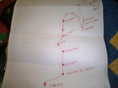
Pilgrim style town name list:
Really concentrates the mind on the evocative connotations of the town names. I did this in Umbria after my bar bag was stolen.
Poggibonsi
Siena
Asciano
Montepulciano
Orvieto
Allerona
Blissfully simple. But reading road signs without my glasses was tricky!
Old school navigation: sun, stars, lichen, compass. Great when your just following a general direction of travel and it really helps keep you mindful of your surroundings.
Geography (A variation of the above)
Following rivers/valleys. Anticipating settlements by the quality of soil/convergence of rivers or the sight of a defensible hill top. When you get it right you feel like a clairvoyant
Getting lost. No destination. Just following roads that look the most fun. Or it’s song celebrated cousin: going whichever way the wind is blowing.
Less poetically – Tourist info maps can be a great resource when on the road. They vary hugely in quality but some are just fantastic and all usually show interesting sights and natural features.
The moment you realise navigating can be a pleasure and take many forms removes so much stress from a tour.
I did toy with the idea of using a smartphone instead of a GPS, but the two main strikes against it were poor battery life and wet weather issues.
I’ve used a compass a few times, most notably in the Salar de Uyuni. They also come in handy for keeping on track in a general direction in a city.
Whenever there is a tourist map around, I tend to pick one up. Even the smallest additional piece of information can be helpful sometimes.
In general though, its whether or not I have enough water and access to it which is the most important thing. Where I actually am is secondary!!